Hot summer comes early this year
The highest temperature in Seoul and other central regions for the first 10 days of this month reached a record high in early June since meteorological observation began in the country. During the period, Seouls average highest temperature exceeded 30 degrees Celsius for the first time since the weather observation began in 1907.
According to the Korea Meteorological Administration, Seouls highest temperature recorded 32.2 degrees Celsius on Monday. The average highest temperature during the first 10 days of June in Seoul was 30.1 degrees Celsius, the highest ever for early June since 1907 and 0.4 degrees Celsius higher than 29.7 in early June in 2001. Considering that the average temperature in normal year during the same period is 26.4 degrees Celsius, this June has been significantly hot.
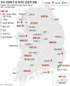
A premature heat wave has been notable in Seoul and other central regions. Over the same period, Suwon in Gyeonggi Province hit an average of 29.5 degrees Celsius, the highest since 1964, and Chungcheong regions also hit records high; Cheongju 30.3, Cheonan 30.0, and Boryeong 26.9. As heat wave is said to be effecting across country, sweeping heat at Chuncheon in Gangwon, Dongducheon in Gyeonggi, Jeonju and Gwangju in Jeolla provinces also recorded as high as the second through the fifth in their meteorological history.
This years early summer heat attributes to a higher than normal sea surface temperature in the Indian Ocean and a drastically reduced size of snowy plateau in Tibet, both of which strengthen the North Pacific high pressure that fuels heat on the Korean Peninsula.
The heat is predicted to be stagnant for three days from Tuesday since rain is expected across the country from Tuesday evening through Wednesday. With the forecast of just about 5 millimeters of light rain, however, the weather will not likely cool down. Daytime temperatures in Seoul are expected to drop to 24 to 28 degrees Celsius through Wednesday, but another heat wave is expected to sweep the country, with temperatures reaching 31 degrees Celsius in Seoul on Friday.
Heat waves on the Korean Peninsula will likely depend on how this years rainy season and typhoons turn out. At the moment, the summer monsoonal front lies between the northern end of Taiwan and far southeastern sea of Japan. Typhoon No. 3 Yagi, which began Saturday in the eastern sea of the Philippines, is passing southeastern sea of Okinawa. Yagi, a small typhoon with central pressure of 992 hectopascal, is expected to turn into an extra-tropical cyclone in three days.
It will be good if Yagi causes rain on the Korean Peninsula and cools the weather. However, it is likely to pass through the east of Japan without affecting Koreas weather. Yagi may cut the monsoonal front in half as it moves. This rarely happens, but if it really occurs, it will weaken the rain front causing the heat on the Korean Peninsula to remain. The rain will not enough to cool the heat through Wednesday," the Korea Meteorological Administration said. Though the typhoon is rather weak, we need to observe it further because the typhoons path is changeable.
Amid continuously hot weather, Ready, the first stage of the power-supply warning system, was issued on Monday. With instant backup power falling under 4.5 million kilowatt at 11:02 a.m. on Monday, Korea Power Exchange issued the warning, which is made when backup power is between 4 million kilowatt and 5 million kilowatt. As the Ready warning was first issued on May 23, followed by issuance on June 3-5 and June 7, a total of six warnings have been made this year.
Korea Power Exchange expects power supply situation will get better as the Hanbit 3 nuclear reactor in South Jeolla Province resumed operation from Monday afternoon and rain is forecast from Tuesday through Wednesday.


Headline News
- N. Korea redefines S. Korea as ‘hostile state’ in revised constitution
- Samsung develops graphic DRAM with industry-leading capacity and speed
- Three questions allegedly leaked via text message during Yonsei Univ. essay test
- China to inject 340 trillion won in loans to support real estate sector
- Dodgers beat Mets to take 2-1 lead in NLCS